Earthquake of magnitude 4.9 - 206 km WSW of Abepura, Indonesia
Earthquake of magnitude 4.9 - 45 km NE of Anamizu, Japan
Earthquake of magnitude 5.8 - 38 km NE of Anamizu, Japan
CALFIRELNU has resources deployed to assist @calfireSCU at the CorralFire. We’ve sent 10 engines, 2 hand crews from Delta Camp, 1 dozer, 1 air attack, 1 helicopter and a battalion chief
 1 godine pre
Firefighters continuing to make progress - the corralfire is now 30% contained and 14,000 acres
 1 godine pre
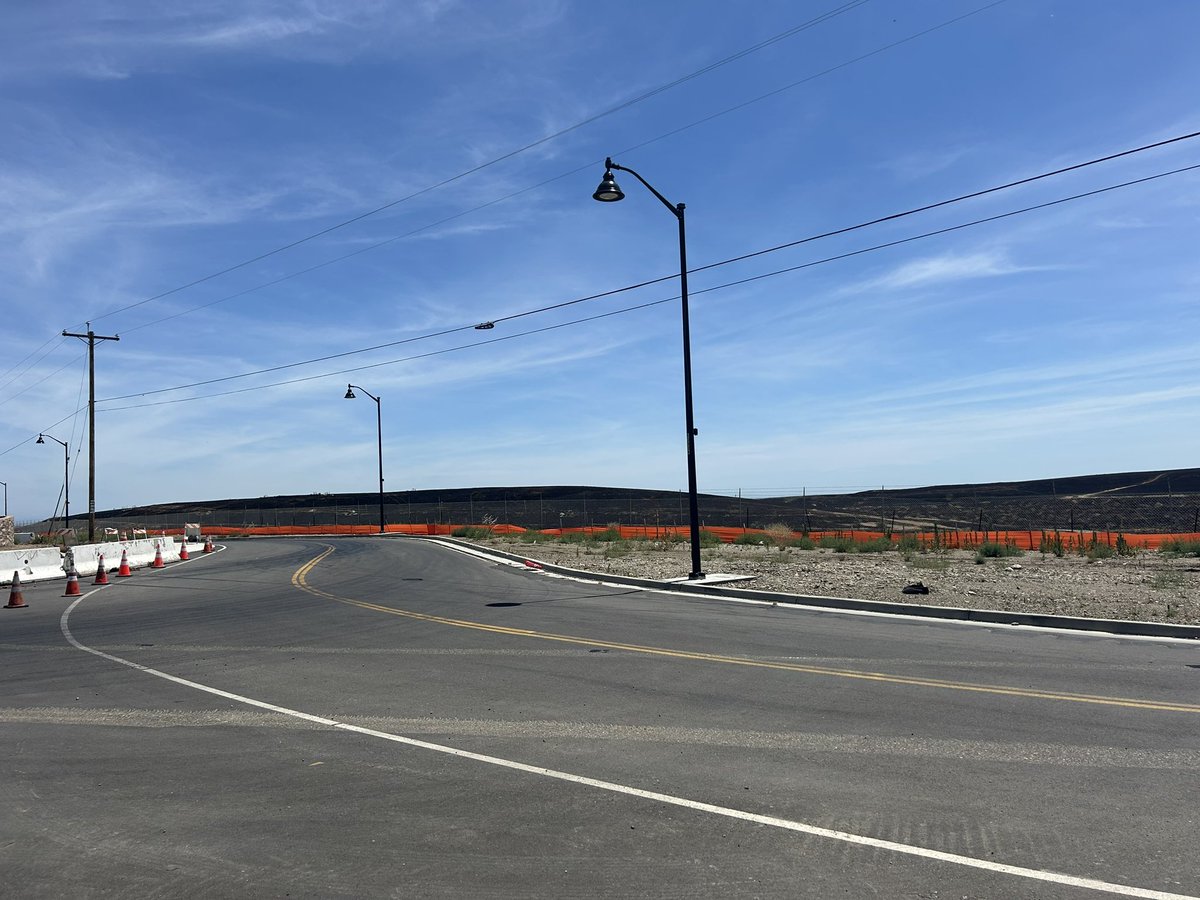
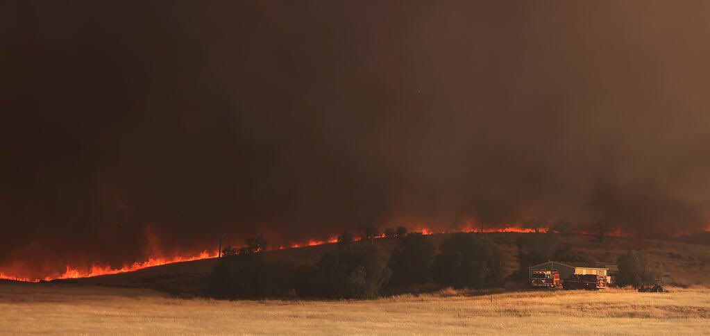
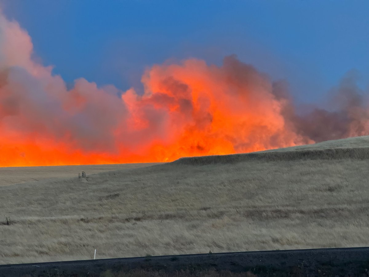
Sunlight has exposed a charred landscape west of the 580 near the city of Tracy nearly 20 square miles of it. At least one home was destroyed as the flames of the CorralFire burned uncontrolled yesterday into the night.
 1 godine pre
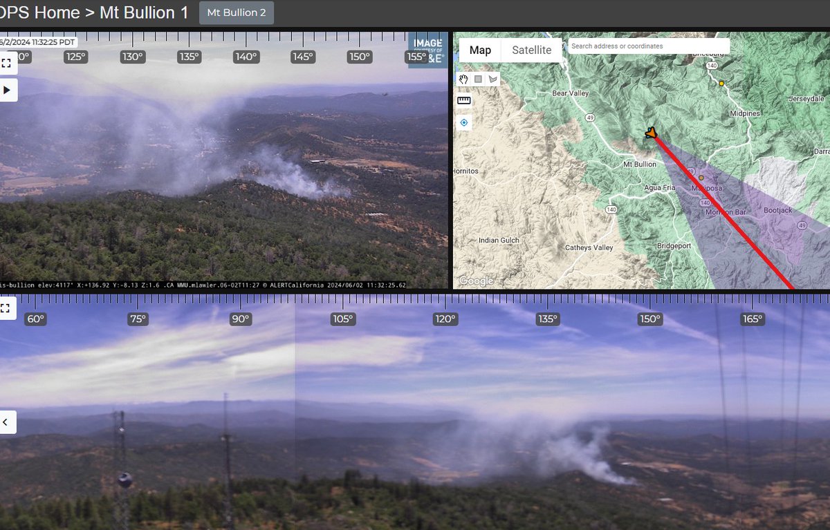
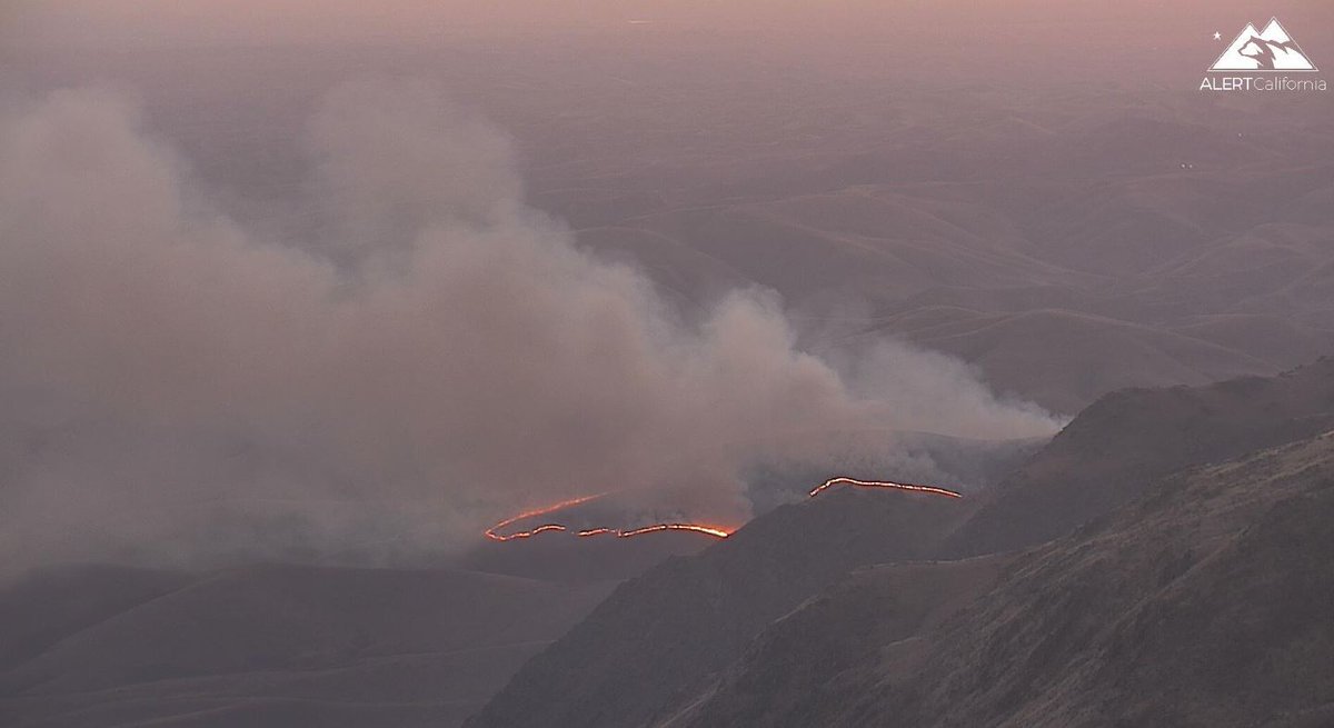
New fire near Mt. Bullion
3.5 magnitude earthquake. 2 mi from South Pasadena, CA, United States
Earthquake of magnitude 5.2 - 139 km SSW of Gizo, Solomon Islands
Earthquake of magnitude 4.9 - Kermadec Islands region
Earthquake of magnitude 4.6 - Pagan region, Northern Mariana Islands
Earthquake of magnitude 4.9 - 284 km NE of Dawson City, Canada
Earthquake of magnitude 5.0 - 41 km NNW of Tobelo, Indonesia
Earthquake of magnitude 4.8 - 92 km SSE of Mawlaik, Myanmar
 1 godine pre
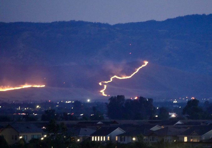
Once the CorralFire became slope aligned with a hot wind pushing it, the fire spotted everywhere, jumping 1-580 several times and burning in the median. @NorthBayNews.
 1 godine pre
The CorralFire burns 11k acres along I-580 near Tracy, on a hot and extremely windy afternoon, prompting evacuations
Corralfire near Lawrence Livermore National Laboratory Site 300 southwest of Tracy is 10,000 acres and 13% contained. In Unified Command
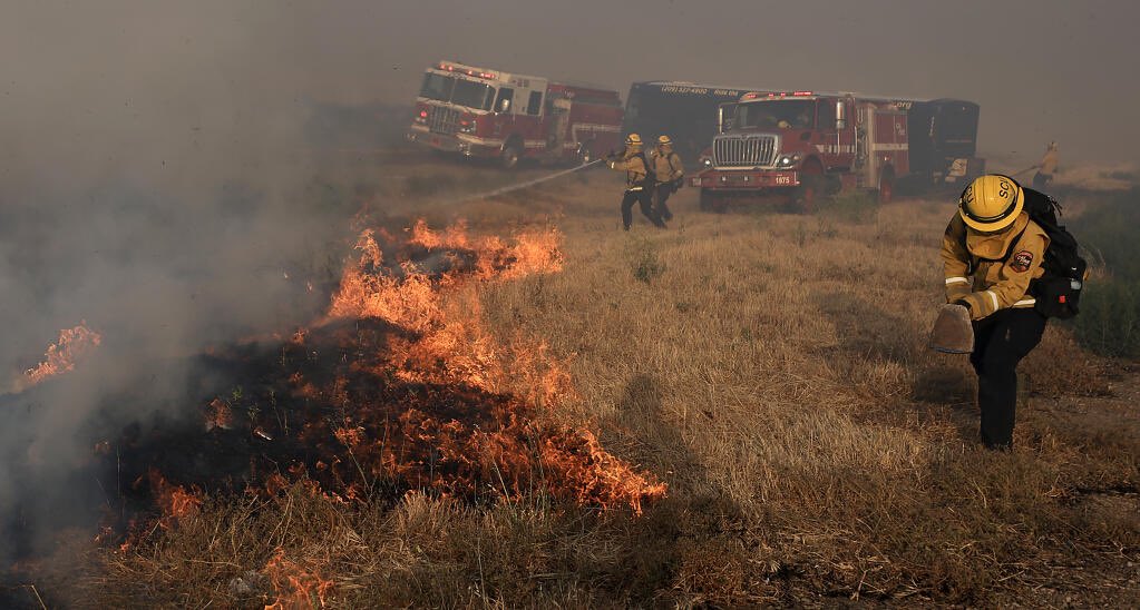
2 firefighters hurt as San Joaquin County grass fire burns thousands of acres, prompts evacuations. CorralFire @ABC10 This video take along I-580 near Tracy. The fire did jump the interstate, but the not a lot of damage from what we saw
Corralfire near Lawrence Livermore National Laboratory Site 300 southwest of Tracy is 9,000 acres and 10% contained. In Unified Command with @calfireSCU @AlamedaCoFire @SJC_OESEvacuation
 1 godine pre
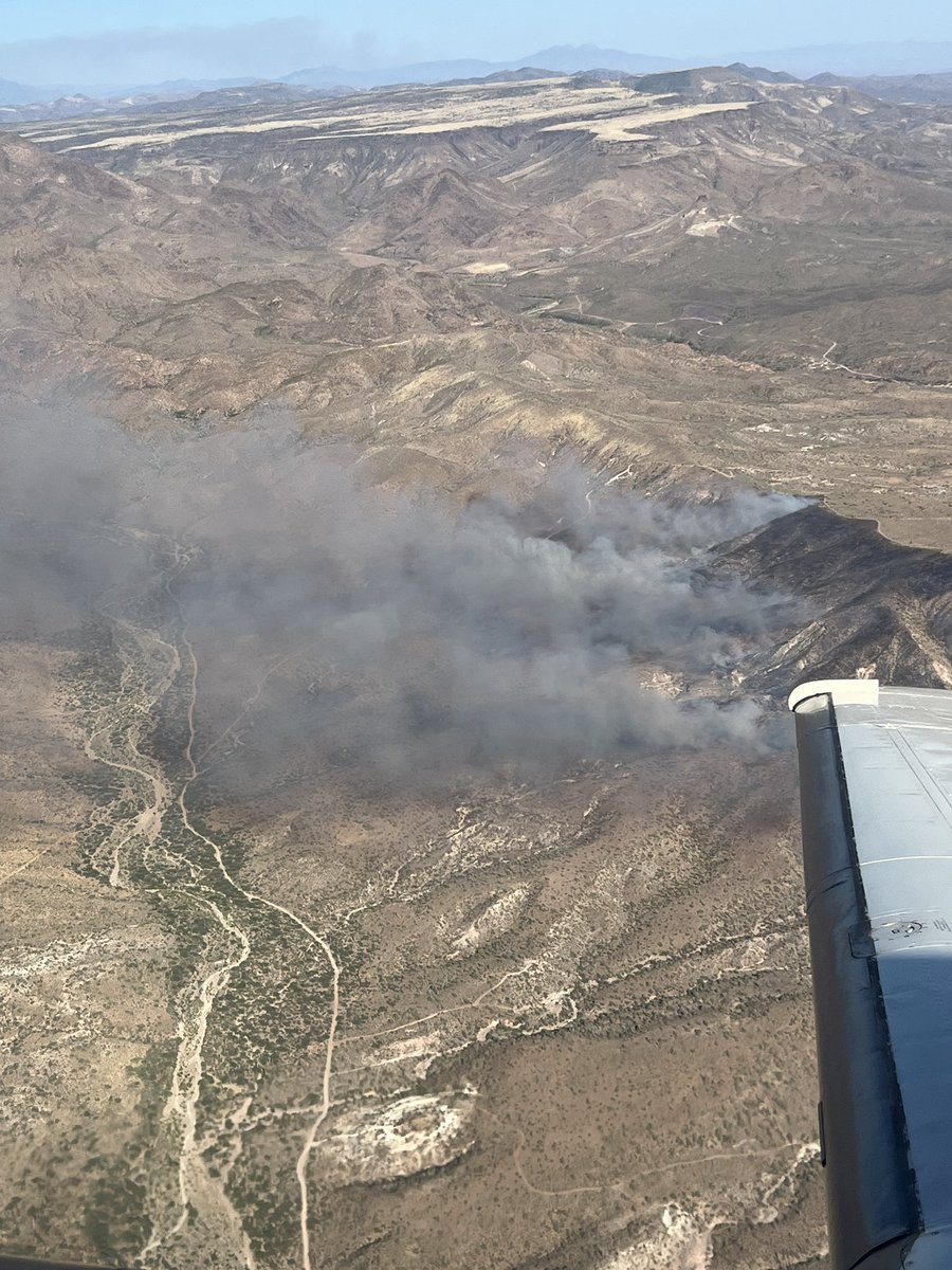
The TableFire loc. near I-17 and Table Mesa is reported at 850 ac with no containment. Hot and dry conditions coupled with light, flashy fuels contributed to today rapid fire growth. Fire moving to north and east. Power lines ahead of the fire to N/NE.
Firefighters that this was an abandoned home and barn. The CorralFire bumped a subdivision hard on the west side of I-580
 1 godine pre
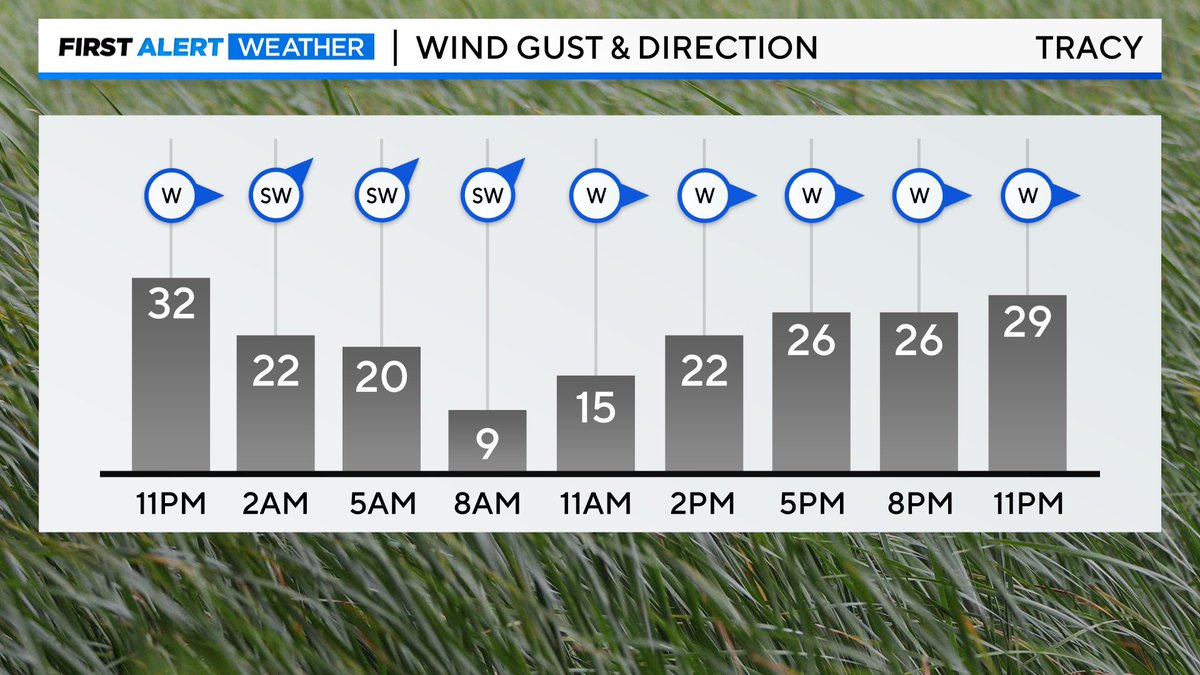
@CALFIRE_PIO now reports the fire is 9,707 acres in size with 10% containment. Wind is still is very strong in the area, even stronger as you get closer to the foothills. Gusts up to 45 MPH will be possible past midnight
 1 godine pre
Corral Fire nearly doubles in size, hitting 8,800 acres.
 1 godine pre
CorralFire that he took from Lathrop. The fire is now over 9,000 acres, CalFire has confirmed to KTVU.
 1 godine pre
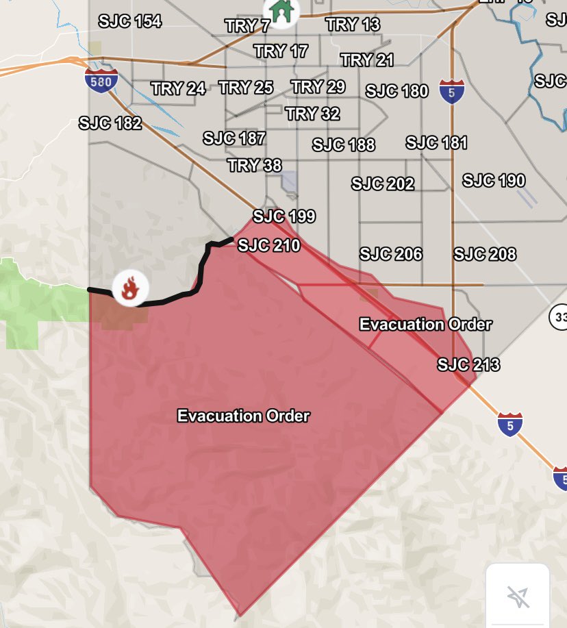
SAN JOAQUIN CO. FIRE: Evacuations ordered for residents west of the California Aqueduct, south of the Corral Hollow Creek, west of Alameda County and south of Stanislaus County. Temporary evacuation point at Larch Clover Community Center in Tracy.
Earthquake of magnitude 4.7 - 60 km SSE of Bitung, Indonesia
The Corral Fire in the Tracy-Livermore area reached 10,000 acres and is 13% contained, Cal Fire says.
Structure seen burning from 9,700-acre Corral Fire which is continuing to grow near Tracy, California; evacuations remain in effect
Earthquake of magnitude 5.2 - Kermadec Islands region
Earthquake of magnitude 4.7 - 105 km WSW of Rabaul, Papua New Guinea
Earthquake of magnitude 5.0 - 28 km SSE of Hualien City, Taiwan
Earthquake of magnitude 4.6 - 96 km SSW of Bengkulu, Indonesia
Earthquake of magnitude 4.8 - 52 km NE of Lae, Papua New Guinea
Overnight Friday into Saturday, CALFIRELNU was in unified command with Esparto FPD on a commercial structure fire with spread into the vegetation off of Yolo CR 22, west of Esparto. The structure of origin was a 3,000-sq-ft commercial building filled with bee boxes and bees wax
Strong local government response, no additional structures were damaged. Additional responding agencies include Capay Valley Fire, the Yocha Dehe Fire Department, Willow Oak FPD, Winters Fire, Madison FPD, Yolo FPD and Woodland Fire
Earthquake of magnitude 4.8 - 81 km NNE of Tobelo, Indonesia
Earthquake of magnitude 5.1 - 38 km ESE of Ransiki, Indonesia
Earthquake of magnitude 5.1 - 42 km WSW of Ollagüe, Chile
Earthquake of magnitude 4.6 - 58 km W of Lata, Solomon Islands
Earthquake of magnitude 4.9 - 108 km ENE of Labasa, Fiji
Earthquake of magnitude 4.9 - Kermadec Islands, New Zealand
 1 godine pre
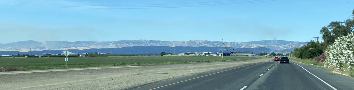
A brush fire, named the Ranch Fire in northeast Bakersfield has burned at least 50 acres, with no known containment, according to brush fire in northeast Bakersfield is burning with no known containment, according to cameras in the area. Fire officials could not be reached at this time for comment
 1 godine pre
A brush fire in northeast Bakersfield is burning with no known containment, according to cameras in the area. Fire officials could not be reached at this time for comment
 1 godine pre
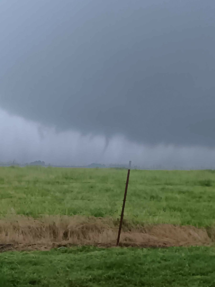
Some minor barn damage in the same area that this funnel/possible tornado was spotted. Both images are from the Gravel Hill Road area in Joy, Arkansas (White County).
 1 godine pre
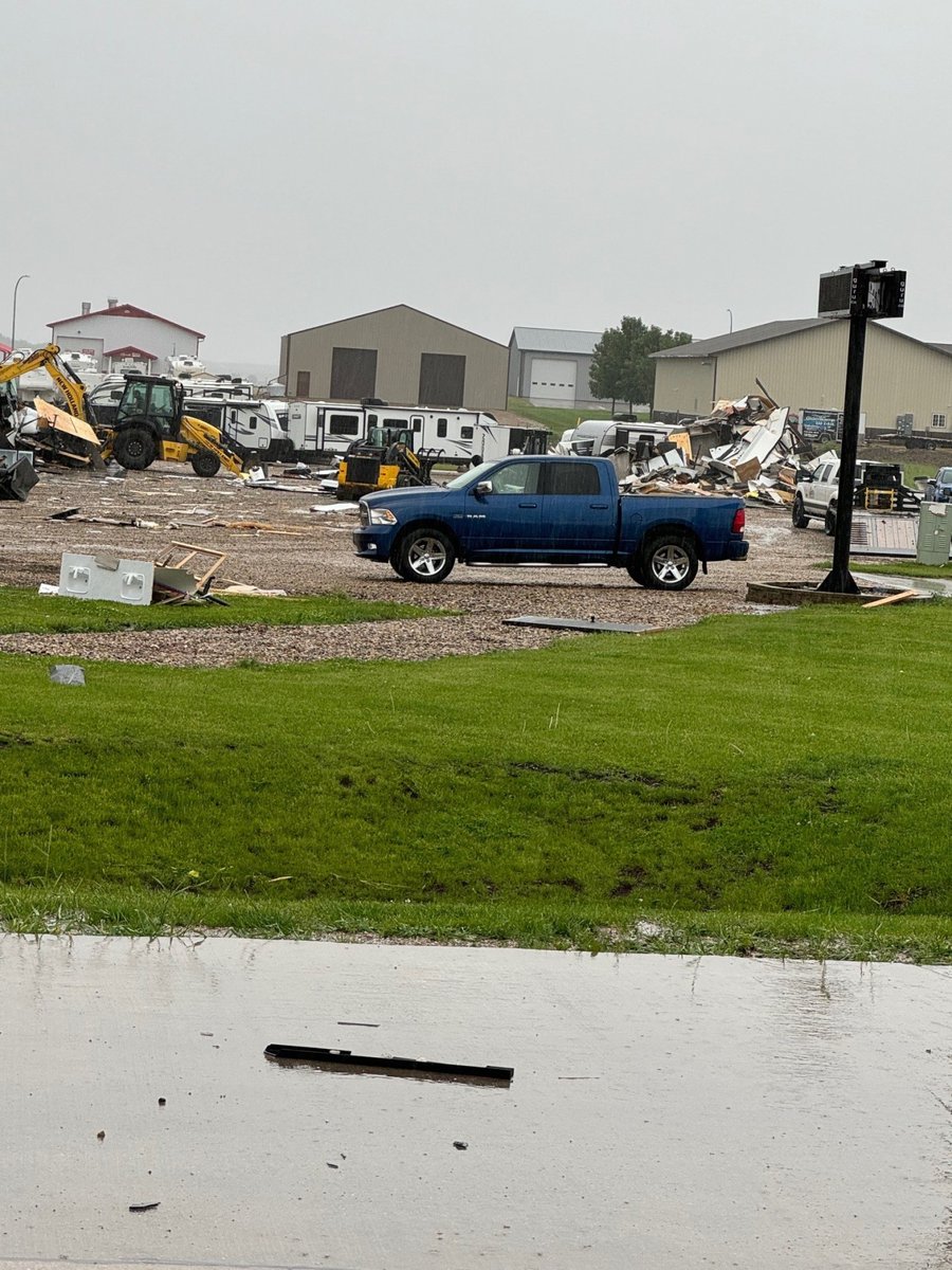
A severe storm damaged several structures in Sheldon, Iowa Friday afternoon. a storm ripped apart several buildings and flipped RVs
Earthquake of magnitude 4.8 - 58 km NW of Pante Makasar, Timor Leste
Earthquake of magnitude 4.6 - 151 km NNW of Masohi, Indonesia
Earthquake of magnitude 4.9 - 159 km ENE of Georgetown, Saint Helena
Earthquake of magnitude 4.7 - 6 km NE of Aras-asan, Philippines
Earthquake of magnitude 5.2 - 151 km ENE of Tatsugō, Japan
Earthquake of magnitude 5.6 - western Xizang
Earthquake of magnitude 4.6 - 70 km SSE of Gorontalo, Indonesia
Earthquake of magnitude 4.8 - Maug Islands region, Northern Mariana Islands
Earthquake of magnitude 5.2 - Kermadec Islands, New Zealand