Earthquake of magnitude 4.8 - 11 km WSW of Chilca, Peru
Earthquake of magnitude 4.9 - 41 km SSW of Neiafu, Tonga
Earthquake of magnitude 4.6 - northwest of the Kuril Islands
Earthquake of magnitude 4.6 - 39 km NNW of Finschhafen, Papua New Guinea
The newly established South Ethiopia region has been hit by a terrible landslide that claimed the lives of 157 people so far
Earthquake of magnitude 4.9 - 32 km SW of Tobelo, Indonesia
Earthquake of magnitude 4.7 - 137 km SE of Perryville, Alaska
Earthquake of magnitude 4.9 - 128 km SE of Perryville, Alaska
Earthquake of magnitude 4.7 - Fiji region
Earthquake of magnitude 4.7 - 104 km SE of Kimbe, Papua New Guinea
USGS reports Magnitude 4.9 earthquake 17 km NE of Hermleigh, Texas
Active Vegetation Fire incident reported in Elysian Park, Los Angeles.
Earthquake of magnitude 4.9 - 17 km NE of Hermleigh, Texas
Earthquake of magnitude 4.9 - 50 km N of Tuapejat, Indonesia
Evacuations ordered in Northern California after lightning sparks 4 fires in Plumas County
Active Vegetation Fire incident reported in Lopez/Kagel Canyons, Los Angeles
Earthquake of magnitude 4.6 - 54 km ESE of Onagawa Chō, Japan
Palmdale,ca: 904B(brush fire) 20th St E and Ave M, 1 acre fire running to the west no structures threatened. Fire dept requesting sheriffs dept for traffic control
Pentagon: Climate change has raised the temperature of the Arctic, which increases human activity in the region
Earthquake of magnitude 4.9 - 4 km E of Limones, Panama
Earthquake of magnitude 5.6 - 13 km SE of Manaca Civil, Panama
Earthquake of magnitude 5.7 - 5 km SSE of Puerto Armuelles, Panama
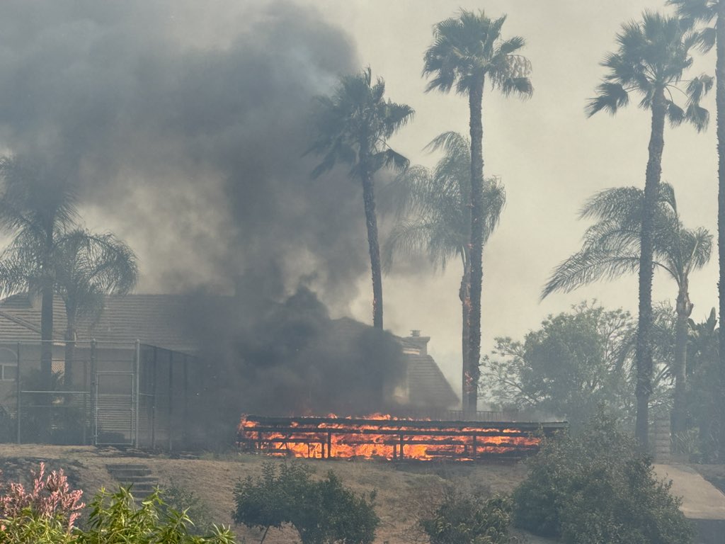
Multiple brush fires broke out in the Inland Empire, charring hundreds of acres, triggering some evacuation orders and burning several homes
Earthquake of magnitude 4.6 - 70 km SW of Cañete, Chile
Earthquake of magnitude 4.6 - 120 km E of Luganville, Vanuatu
Earthquake of magnitude 5.1 - 176 km W of Tual, Indonesia
Earthquake of magnitude 5.1 - 103 km ENE of Norsup, Vanuatu
A 3.5 magnitude earthquake rattled the California coast near Rancho Palos Verdes on Sunday
Earthquake of magnitude 4.9 - southeast of the Loyalty Islands
The Sandhurst Fire, burning near Ensign Peak in Utah, was mapped at 400 acres Sunday morning and 0% contained
 4 місяць тому
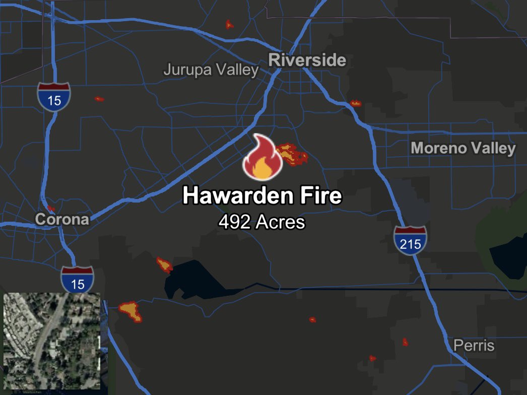
HawardenFire burned 492 acres in mere hours, destroying 3 homes in Riverside and damaging at least 4 more. Aerials from NewsChopper4 captured the breadth of the burn zone and air quality impacts. We could see thick smoke from 30 miles away
Riverside County, marked by two major fires: the Eagle Fire near Corona and the Hawarden Fire in Riverside City. The Hawarden Fire, in particular, was devastating, resulting in the loss of multiple structures
 4 місяць тому
Structures are being impacted in this entire area and I have yet to see one resource since I have been here
The Hawarden Fire, which has officially eclipsed 500 acres, continues to burn in Riverside, which can be seen with SkyCal overhead the scene
Earthquake of magnitude 4.6 - 45 km E of Farkhār, Afghanistan
Earthquake of magnitude 5.2 - South Sandwich Islands region
Earthquake of magnitude 5.0 - 89 km NE of Norsup, Vanuatu
Earthquake of magnitude 6.0 - 90 km NE of Norsup, Vanuatu
Earthquake of magnitude 6.0 - 96 km NE of Norsup, Vanuatu
Earthquake of magnitude 4.9 - 84 km ENE of Kainantu, Papua New Guinea
Earthquake of magnitude 4.9 - 100 km E of Luganville, Vanuatu
Earthquake of magnitude 4.7 - 108 km E of Luganville, Vanuatu
Earthquake of magnitude 4.7 - 12 km E of Kitaibaraki, Japan
Earthquake of magnitude 4.6 - 63 km WSW of San Antonio de los Cobres, Argentina
Earthquake of magnitude 5.5 - 50 km NE of Isangel, Vanuatu