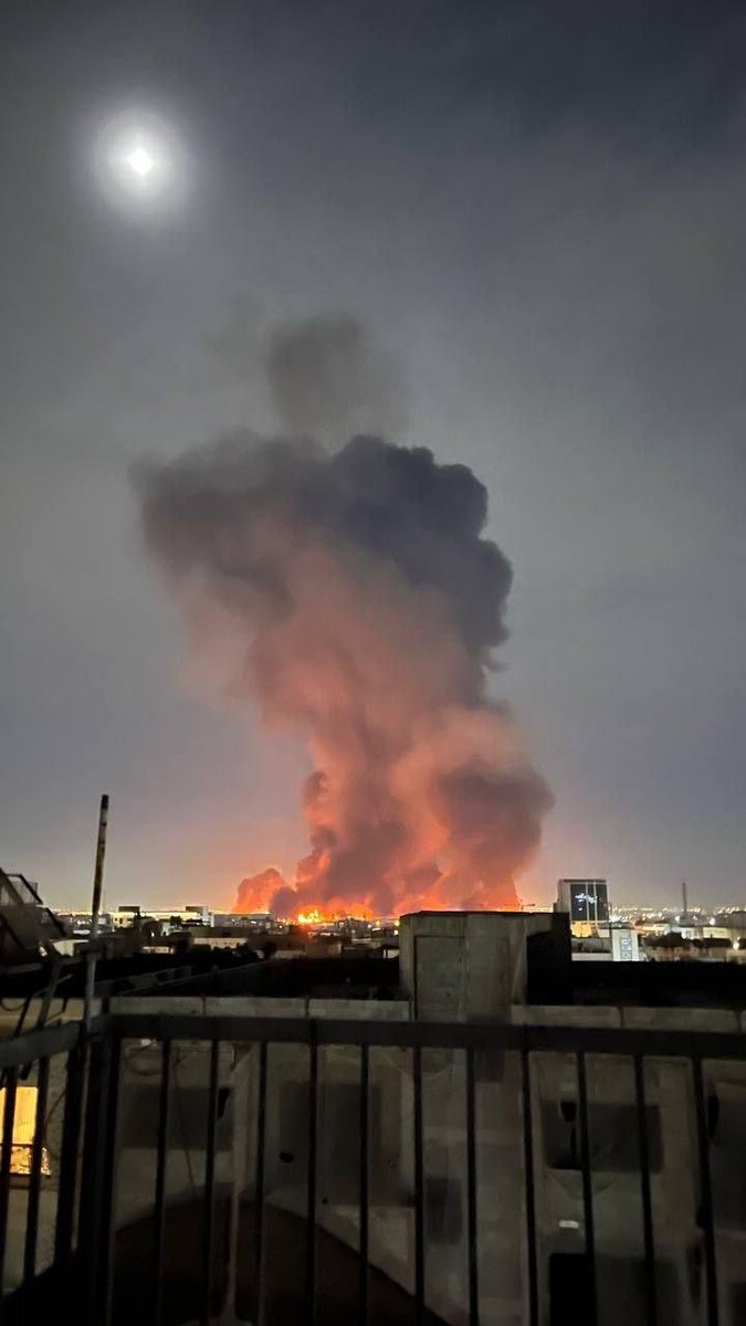
VEGETATION FIRE 28700 block of Highway 74, unincorporated Lake Elsinore. Firefighters are on-scene of 1/4 acre of vegetation burning at a moderate rate of spread. Additional engines have been requested
Earthquake of magnitude 4.9 - Kermadec Islands, New Zealand
Earthquake of magnitude 4.6 - Volcano Islands, Japan region
Earthquake of magnitude 4.9 - 125 km NE of Lospalos, Timor Leste
Earthquake of magnitude 4.9 - 57 km NNW of Hirara, Japan
Earthquake of magnitude 4.9 - 52 km NNW of Hirara, Japan
Earthquake of magnitude 4.6 - 141 km ENE of Santa Cruz das Flores, Portugal
Earthquake of magnitude 4.9 - 46 km NNW of Hirara, Japan
Earthquake of magnitude 5.6 - 65 km NW of Hirara, Japan
Earthquake of magnitude 4.9 - 0 km SE of Cadagmayan Norte, Philippines
Earthquake of magnitude 4.6 - 175 km SSE of Vilyuchinsk, Russia
Earthquake of magnitude 5.0 - 59 km NW of Hirara, Japan
Earthquake of magnitude 4.8 - 149 km SE of Vilyuchinsk, Russia
Earthquake of magnitude 4.9 - Volcano Islands, Japan region
Earthquake of magnitude 6.1 - Volcano Islands, Japan region
Earthquake of magnitude 5.1 - central Mid-Atlantic Ridge
Earthquake of magnitude 4.8 - 104 km W of Lata, Solomon Islands
Earthquake of magnitude 5.1 - 43 km NNE of Calama, Chile
Earthquake of magnitude 4.7 - 147 km SE of Vilyuchinsk, Russia
Earthquake of magnitude 4.9 - South Sandwich Islands region
Earthquake of magnitude 5.0 - 133 km SE of Vilyuchinsk, Russia
Earthquake of magnitude 4.6 - 99 km ENE of Noda, Japan
Earthquake of magnitude 5.2 - north of Ascension Island
Earthquake of magnitude 4.8 - 119 km N of Tobelo, Indonesia
Earthquake of magnitude 5.1 - northern Mid-Atlantic Ridge
Earthquake of magnitude 4.8 - 78 km NE of Tonopah, Nevada
2.9 magnitude earthquake. 12 mi from Aguanga, CA, United States
 3 Woche zuvor
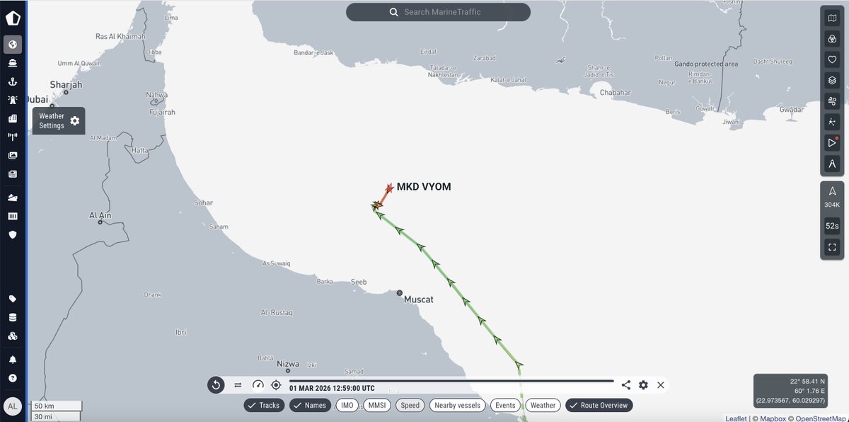
Tanker vor Oman getroffen – Ölkatastrophe droht: Der unter der Flagge der Marshallinseln fahrende Tanker MKD Vyom wurde laut maritimen Sicherheitskreisen vor der Küste Omans von einem Geschoss getroffen. Der Vorfall ereignete sich etwa 44,4 Seemeilen nordwestlich von Maskat und gibt Anlass zur Sorge um die Schifffahrtssicherheit und mögliche Umweltauswirkungen in der Region. Laut Daten von MarineTraffic war der 272 Meter lange Tanker zum Zeitpunkt des Vorfalls beladen und befand sich in den Gewässern vor der Nordküste Omans.
Earthquake of magnitude 5.0 - 4 km SSE of Arboledas, Colombia
Earthquake of magnitude 5.5 - 21 km SW of Ibusuki, Japan
Earthquake of magnitude 4.7 - 294 km ENE of Lospalos, Timor Leste
Earthquake of magnitude 4.9 - 113 km SE of Hihifo, Tonga
Earthquake of magnitude 6.3 - Fiji region
Earthquake of magnitude 4.7 - 78 km NNW of Hirara, Japan
2.6 magnitude earthquake. 16 mi from Salton City, CA, UnitedStates
Earthquake of magnitude 4.9 - South Sandwich Islands region
Earthquake of magnitude 4.6 - 44 km N of Valparaíso, Chile