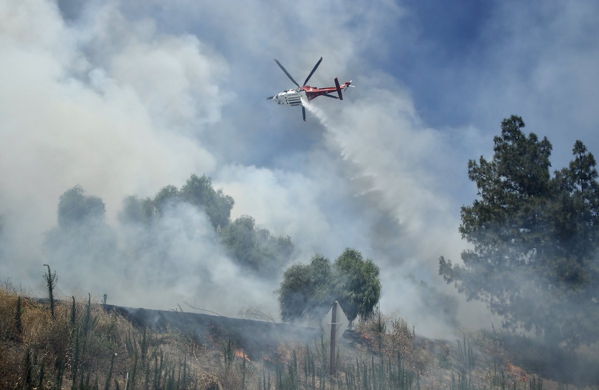
BonnyFire off the 45000 Block of Bonny Lane near Aguanga in Riverside County is 877 acres and 5% contained.
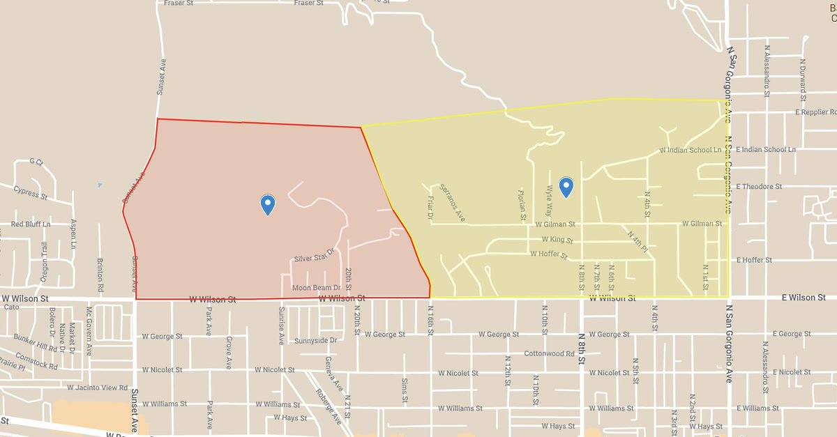
SunsetFire off of Mesa Street and Gilman Street, near Banning in Riverside County is 103 acres and 90% contained.
Earthquake of magnitude 5.6 - South Sandwich Islands region
Earthquake of magnitude 5.6 - Andaman Islands, India region
Earthquake of magnitude 4.8 - 70 km SE of Kokhanok, Alaska
Earthquake of magnitude 4.7 - Santa Cruz Islands
Earthquake of magnitude 5.0 - Fiji region
Earthquake of magnitude 4.8 - 75 km NE of Port-Olry, Vanuatu
Earthquake of magnitude 4.8 - South Sandwich Islands region
BonnyFire off the 45000 Block of Bonny Lane near Aguanga in Riverside County is 500 acres and 10% contained.
TurkeyFire off Turkey Creek Trail and Swedes Flat Road, near Bangor in Butte County is 65 acres and 80% contained.
Earthquake of magnitude 4.7 - West Chile Rise
Earthquake of magnitude 4.7 - south of the Fiji Islands
Earthquake of magnitude 4.7 - 116 km SW of Akhiok, Alaska
Earthquake of magnitude 4.8 - 102 km ENE of Port-Olry, Vanuatu
Earthquake of magnitude 5.9 - Southwest Indian Ridge
Earthquake of magnitude 4.7 - 125 km SE of Hiroo, Japan
Earthquake of magnitude 4.9 - Southwest Indian Ridge
Earthquake of magnitude 5.4 - Southwest Indian Ridge
Earthquake of magnitude 5.6 - Southwest Indian Ridge
New Incident: SunsetFire off of Mesa Street cross of Gilman Street, near Banning in Riverside County is 103 acres and 50% contained
The SunsetFire has burned 103 acres in Banning. The fire is 50% contained. All evacuation orders and warnings remain in place
 1 année il y a
An EVACUATION ORDER has been issued for the following area: South of Silver Star Drive, East of Sunset Ave, North of Wilson St and West of 16th St.nnAn EVACUATION has been issued for: North of Wilson Street, East of 16 th St
A brush fire that erupted near the Cahuilla Indian Reservation south of Aguanga in Riverside County has consumed roughly 225 acres
Earthquake of magnitude 4.6 - Eastern Xizang
Brush fire burning near Tecate, Calif., structures threatened
 1 année il y a
brushfire along the 118 today in GrenadaHills
Earthquake of magnitude 4.7 - South Sandwich Islands region
Earthquake of magnitude 4.9 - south of the Mariana Islands
Earthquake of magnitude 4.8 - 94 km SSE of Sola, Vanuatu
Earthquake of magnitude 4.8 - 27 km SSW of Palora, Ecuador
Earthquake of magnitude 5.0 - 205 km NNE of Shi Yomi, India
Earthquake of magnitude 5.0 - 88 km ENE of Port-Olry, Vanuatu
Earthquake of magnitude 5.1 - central Mid-Atlantic Ridge
Earthquake of magnitude 4.9 - central Mid-Atlantic Ridge
Earthquake of magnitude 5.1 - south of the Fiji Islands
Earthquake of magnitude 4.6 - 94 km NW of Copiapó, Chile
Earthquake of magnitude 5.3 - 90 km NE of Shikotan, Russia
Earthquake of magnitude 5.0 - 91 km SSE of Sola, Vanuatu
Earthquake of magnitude 4.9 - 91 km SSE of Sola, Vanuatu
Earthquake of magnitude 4.6 - 104 km SSE of Sola, Vanuatu
Earthquake of magnitude 5.5 - 94 km ENE of Port-Olry, Vanuatu
 1 année il y a
Daisy Mountain crews, along with @PHXFire @PeoriaFire did an outstanding job getting this brush fire under control. The fire (just west of Ben Avery Shooting Range) was held to approx 2 acres. nnCause of the fire is unknown no injuries were reported
The fire has burned an estimated 250 acres, and officials say some residents in Blum are under voluntary evacuations
Whittier. Brush fire. Rosemead Bl., and Durfee Ave. DanielleFire. IC updates: this is held at 4 acres with forward progress stopped. Units out 1 hour for mop up
Whittier. Brush fire. Rosemead Bl., and Durfee Ave. DanielleFire. BC8 is now IC. This is still 1 acre, in heavy fuels, 100% LRA (local land). Potential is 5 acres and 0% containment
Whittier. Brush fire. Rosemead Bl., and Durfee Ave. DanielleFire. LACoFD E90 reports 1 acre burning in medium to heavy fuels with no structures threatened
Earthquake of magnitude 5.5 - 81 km SSE of Sola, Vanuatu
Earthquake of magnitude 5.0 - 118 km SE of Sola, Vanuatu
Earthquake of magnitude 5.6 - 137 km ESE of Hihifo, Tonga
Earthquake of magnitude 5.5 - 109 km ESE of Hihifo, Tonga
Earthquake of magnitude 4.8 - Izu Islands, Japan region
Earthquake of magnitude 5.1 - 82 km SSE of Sola, Vanuatu