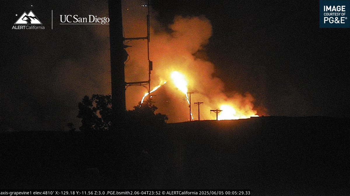
 6 mes atrás
New Brush Fire Fort Tejon Road/S I-5, Grapvine, Kern County.5 acres running uphill
Earthquake of magnitude 4.7 - 35 km NW of Mýrina, Greece
Earthquake of magnitude 4.9 - 63 km NW of Ocampo, Mexico
Earthquake of magnitude 5.7 - 299 km SW of Arenas, Panama
Earthquake of magnitude 5.0 - 23 km NNW of Zibihu, China
Tornado sirens went off a couple of minutes ago in Maryland Heights.
Earthquake of magnitude 4.6 - 81 km SSE of Kushiro, Japan
3.6 magnitude earthquake. 5 mi from Idyllwild, CA, UnitedStates
Earthquake of magnitude 5.0 - 137 km SSE of Lata, Solomon Islands
Earthquake of magnitude 5.2 - 156 km WSW of Fakfak, Indonesia
Earthquake of magnitude 4.6 - Izu Islands, Japan region
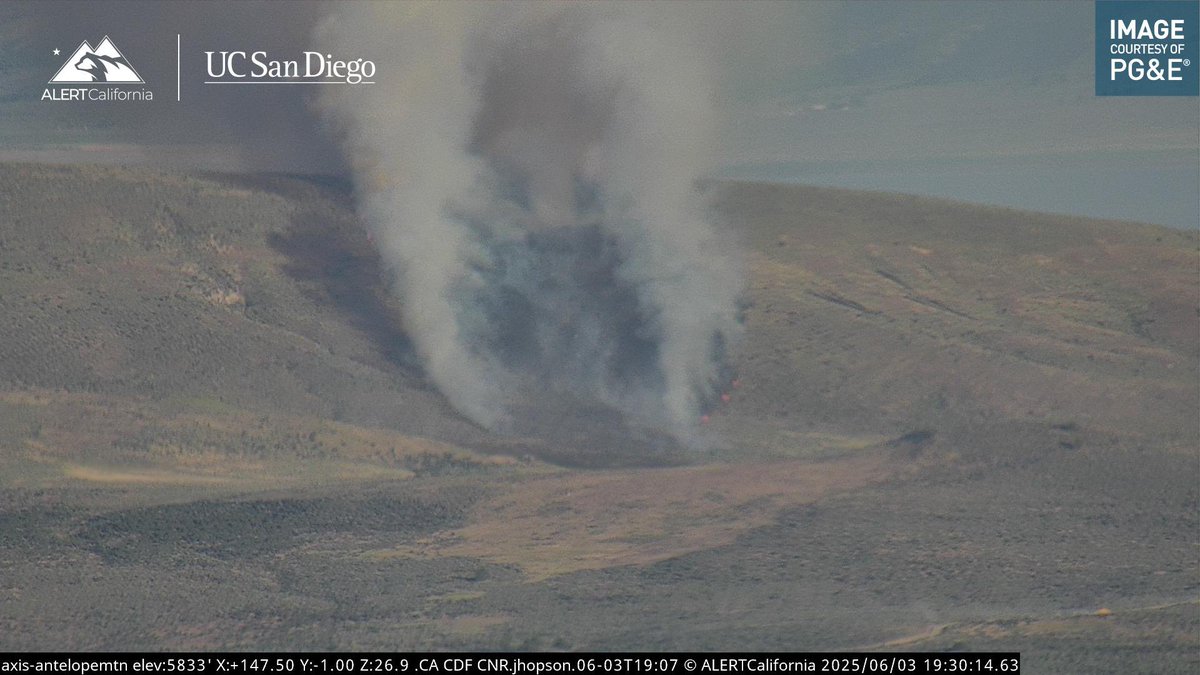 6 mes atrás
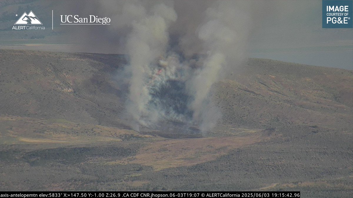
Byers Fire AA210 is requesting two additional Type 3 Air Tankers.The Fire is 60 acres, pushing to the East, still potential for 100 acres
 6 mes atrás
New Brush Fire Byers Pass Road, Janesville, Lassen County.15 acres, Moderate ROS, Potential for 100 acres, no structures threatened
Earthquake of magnitude 4.7 - western Xizang
Earthquake of magnitude 4.6 - 55 km WNW of Te Anau, New Zealand
Earthquake of magnitude 4.7 - 43 km W of Adak, Alaska
Earthquake of magnitude 4.7 - 22 km W of Adak, Alaska
Earthquake of magnitude 5.0 - 45 km W of Adak, Alaska
 6 mes atrás
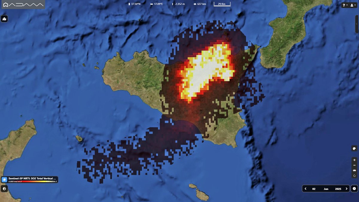
El primer paroxismo del Etna en los últimos 18 meses desde el espacio. El mapa Sentinel5p de Copernicus del 2 de junio muestra la columna de SO2 relacionada con la erupción en el cráter Southeast.
Earthquake of magnitude 5.0 - 57 km SSE of Hiroo, Japan
Earthquake of magnitude 4.9 - 9 km SSE of Ierápetra, Greece
Earthquake of magnitude 5.2 - 177 km NNW of Arawa, Papua New Guinea
Earthquake of magnitude 4.9 - 120 km E of Bitung, Indonesia
 6 mes atrás
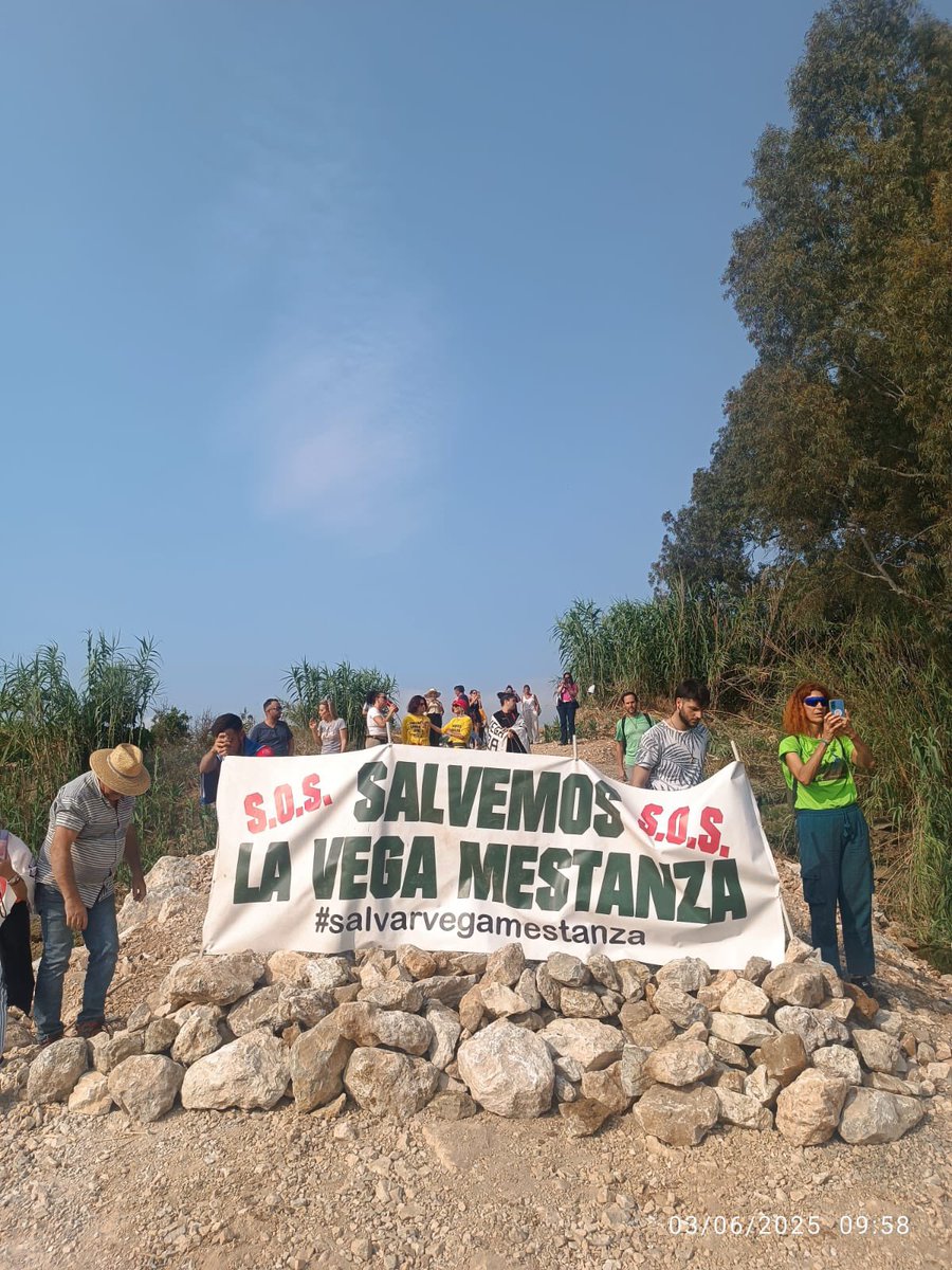
Manifestantes en la Vega Mestanza han puesto barricadas para que no se puedan iniciar hoy la tala de 20.000 naranjos
Earthquake of magnitude 5.0 - 83 km S of Finschhafen, Papua New Guinea
Earthquake of magnitude 4.7 - Kermadec Islands region
6.2-MAGNITUDE Earthquake STRIKES GREECE NEAR TURKEY BORDER A 6.2-magnitude earthquake hit the Dodecanese Islands of Greece early Tuesday, close to the Turkish border, according to the European Mediterranean Seismological Centre
Earthquake of magnitude 4.6 - 2 km E of Lázaro Cárdenas, Mexico
Earthquake of magnitude 5.8 - 5 km S of İçmeler, Turkey
Earthquake of magnitude 4.6 - Banda Sea