2.8 magnitude earthquake. 7 mi from Seeley, CA, UnitedStates
At least 4 dead in San Antonio after heavy rains flood parts of Texas
Earthquake of magnitude 4.8 - 114 km NE of Kimbe, Papua New Guinea
At least 4 dead and 2 missing in San Antonio after heavy rains flood parts of Texas
Earthquake of magnitude 4.9 - 26 km SSW of Sarangani, Philippines
Earthquake of magnitude 4.9 - Vanuatu region
Earthquake of magnitude 4.9 - 151 km E of Masohi, Indonesia
Earthquake of magnitude 5.0 - Pacific-Antarctic Ridge
Earthquake of magnitude 4.8 - 155 km S of ‘Ohonua, Tonga
Earthquake of magnitude 5.3 - Pacific-Antarctic Ridge
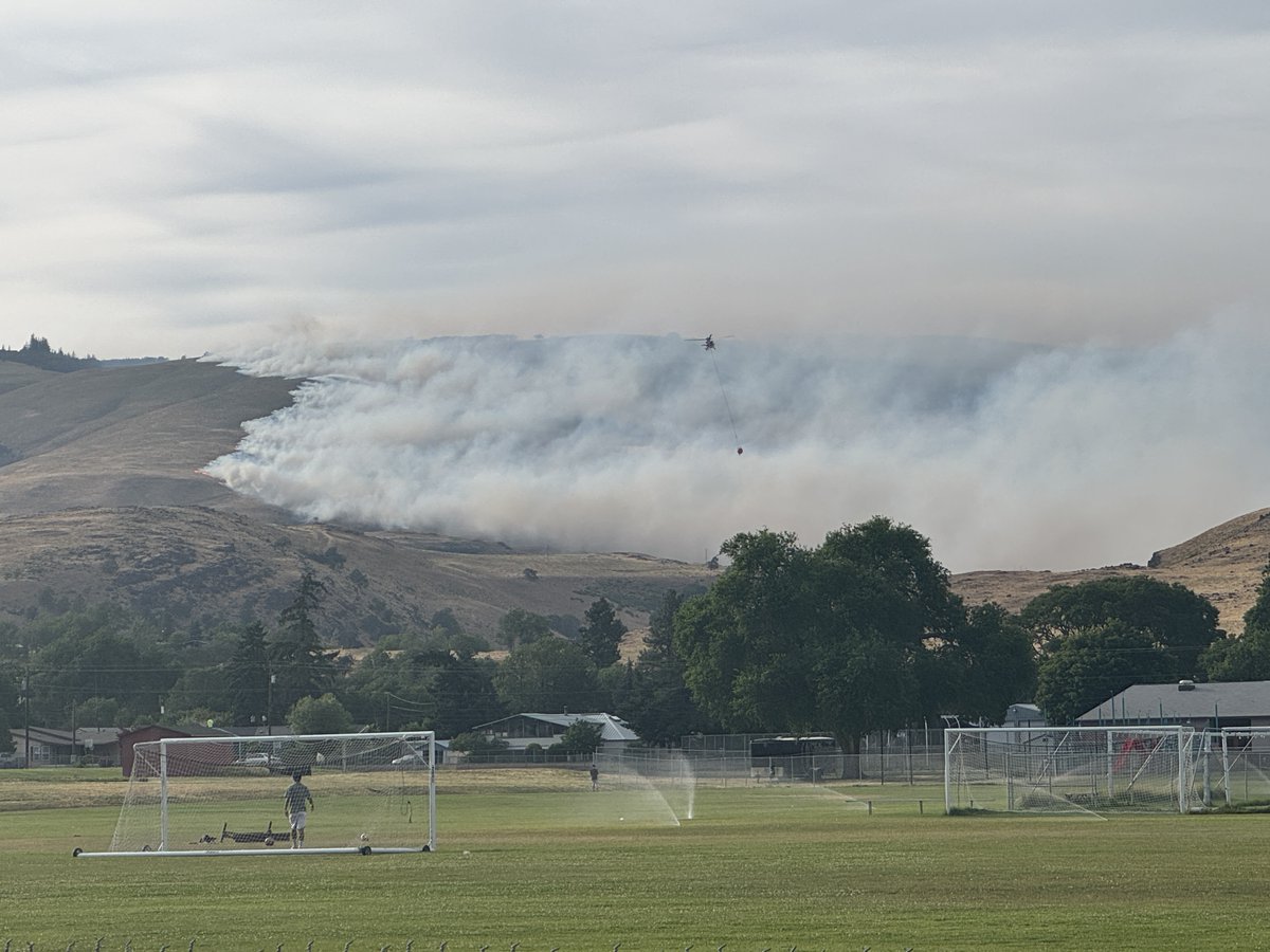
More than 3,300 homes were under evacuation orders late Wednesday night as firefighters battled a wildfire burning in the Columbia River Gorge that, according to the state fire marshal, had burned to the edge of The Dalles
Earthquake of magnitude 5.1 - Pacific-Antarctic Ridge
Earthquake of magnitude 5.7 - Pacific-Antarctic Ridge
Earthquake of magnitude 4.7 - 134 km SW of Fakfak, Indonesia
Earthquake of magnitude 4.9 - 125 km S of Ōyama, Japan
Earthquake of magnitude 5.0 - 11 km NW of Jayanca, Peru
 5 mes atrás
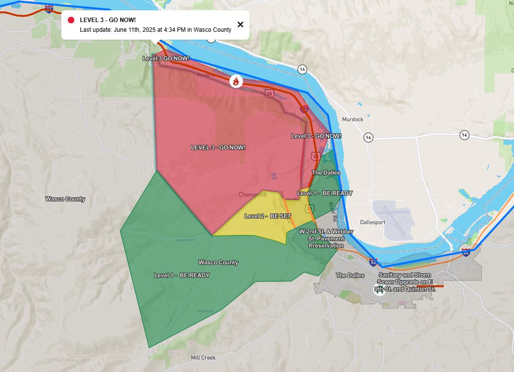
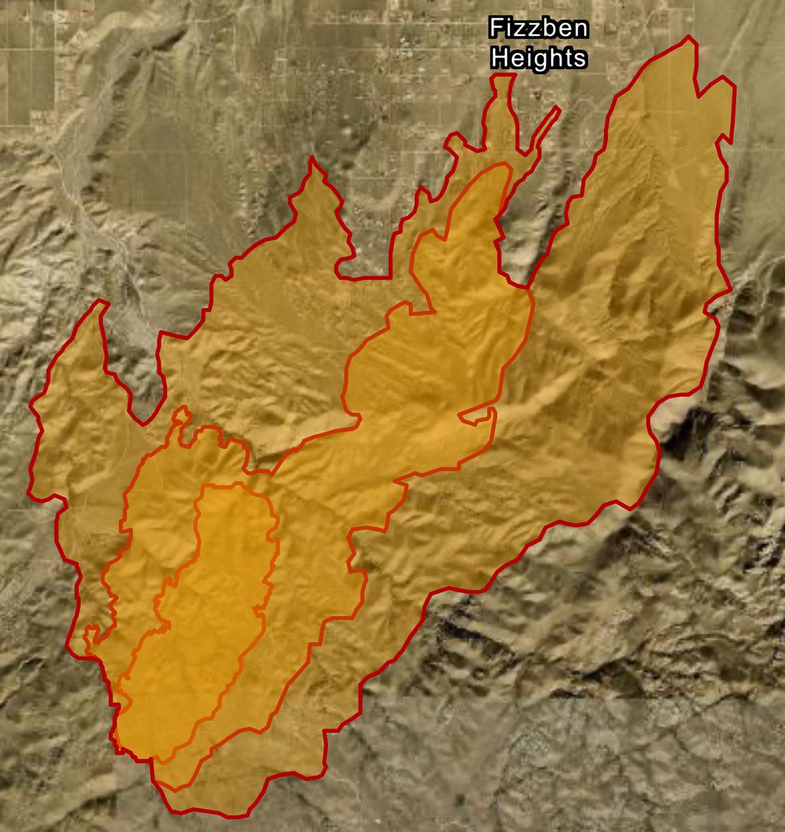
Evacuation orders are in place and part of I-84 is closed due to a 500-acre fire burning in northern Oregon. The Wasco County Sheriff's Office has ordered over 700 homes to evacuate from the area of the Rowena Fire, burning on the Oregon/Washington border
 5 mes atrás
Evacuation from Rowena Ferry Rd. east to River Rd. Seven Mile Hill Rd to Mountain View Dr., south to Chenowith Creek Rd and Browns Creek Rd., east to W 7th St. LEVEL 2 BE SET Evacuation Snipes, west to Chenoweth
Earthquake of magnitude 4.7 - Bonin Islands, Japan region
Earthquake of magnitude 5.2 - 132 km S of Isangel, Vanuatu
Earthquake of magnitude 4.7 - 66 km SSE of Adak, Alaska
Earthquake of magnitude 5.9 - 71 km S of Hualien City, Taiwan
Earthquake of magnitude 4.6 - 75 km S of Kushiro, Japan
Earthquake of magnitude 4.6 - 9 km NW of Lingig, Philippines
Earthquake of magnitude 5.2 - 69 km NW of Sola, Vanuatu
Earthquake of magnitude 4.8 - 1 km W of La Reforma, Mexico
A brush fire has closed U.S. Route 2 between Stevens Pass and Leavenworth
Wind-driven Ranch fire in Apple Valley sparks evacuation order
 6 mes atrás
OES Intel 24 has mapped the RanchFire at 4,205 acres.VCFD Helitanker 40 and CalFire Copter 609 are refueling, no other aircraft has been requested
Earthquake of magnitude 4.7 - Fiji region